Irrigation in the West, visualized with National Hydrography Dataset
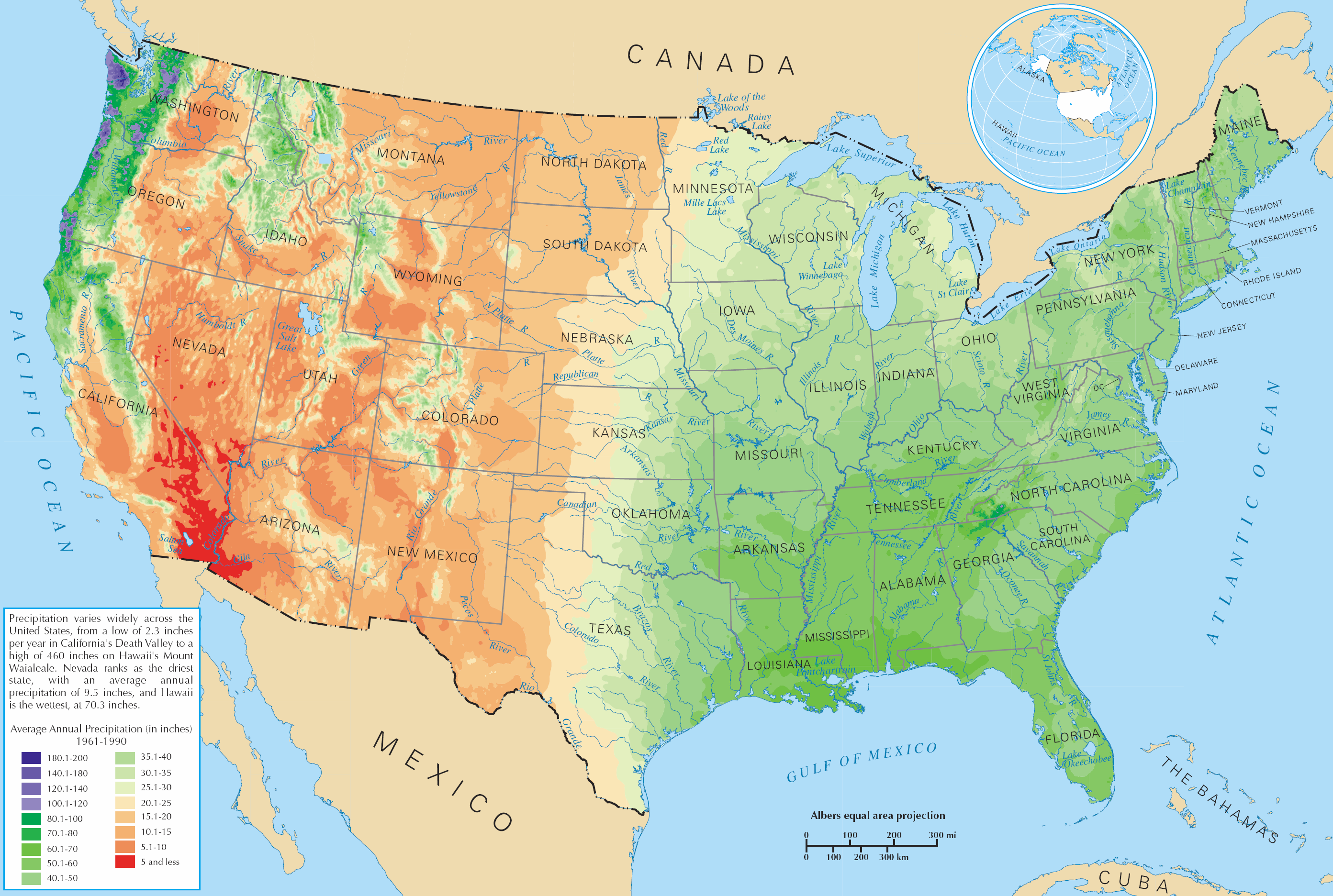
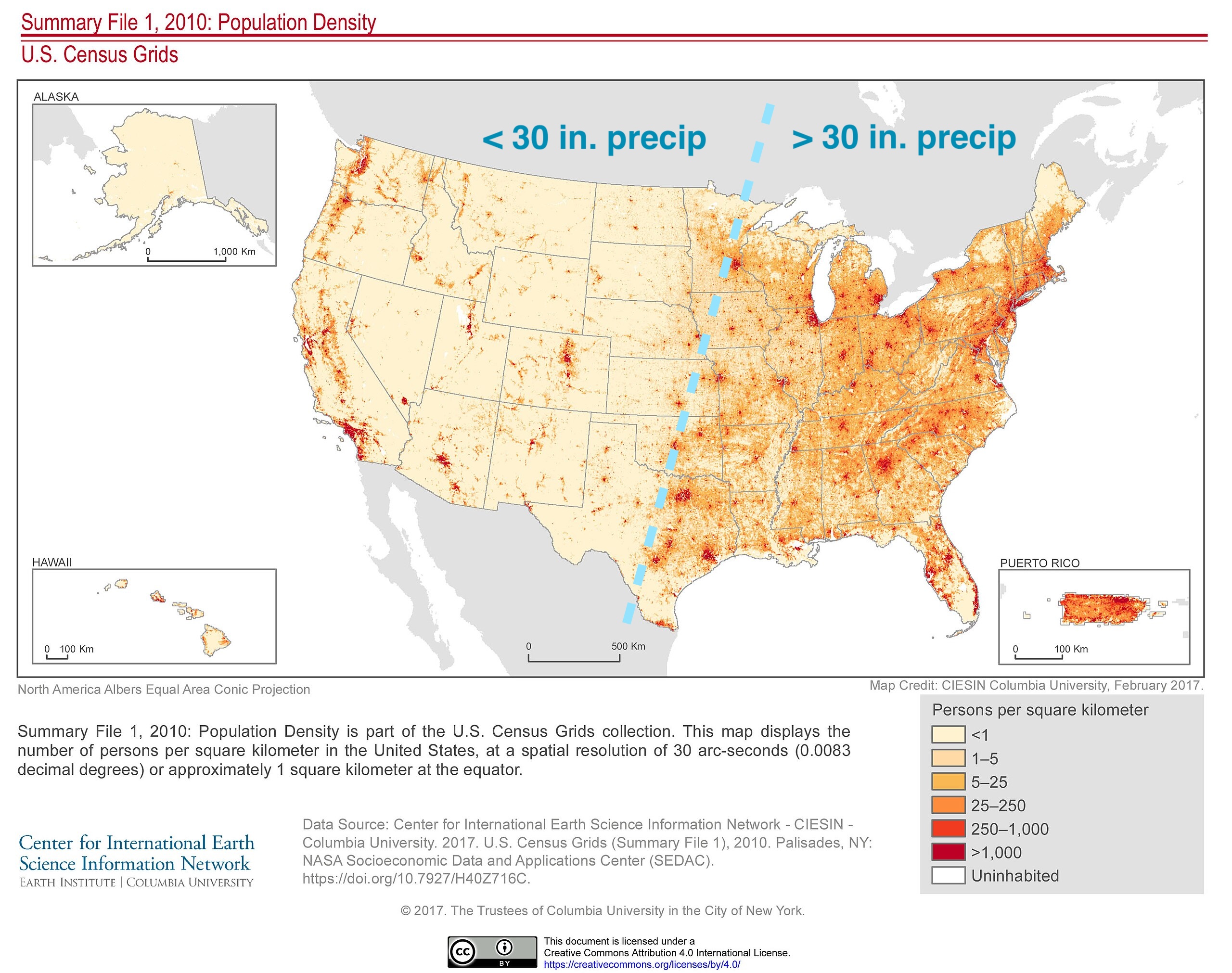
In the United States there is a clear pattern of human settlement where to the East, there is more than 30 inches of rainfall and so crops can be grown without irrigation, and to the West, irrigation is required. This post is an exploration of population density, precipitation rates, and the National Hydrography Dataset (NHD)...
Average annual precipitation

Attribution: United States Department of the Interior nepes, Public domain, via Wikimedia Commons
Population density
I added the blue dotted line to hilite the pattern going from Wisconsin down to Texas.

Attribution: SEDACMaps, The Trustees of Columbia University in the City of New York: CC BY 4.0 , via Wikimedia Commons
Acequias, canals, and ditches in the West
In the West, human settlements were only possible where water exists and agriculture was possible. Acequias, irrigation ditches and canals are the technology that makes this possible.
An acequia is a community-operated watercourse used in Spain and former Spanish colonies in the Americas for irrigation. Acequias are found in parts of Spain, the Andes, northern Mexico, and the modern-day American Southwest (northern New Mexico and southern Colorado). source: Wikipedia.
Visualize irrigation with the NHD
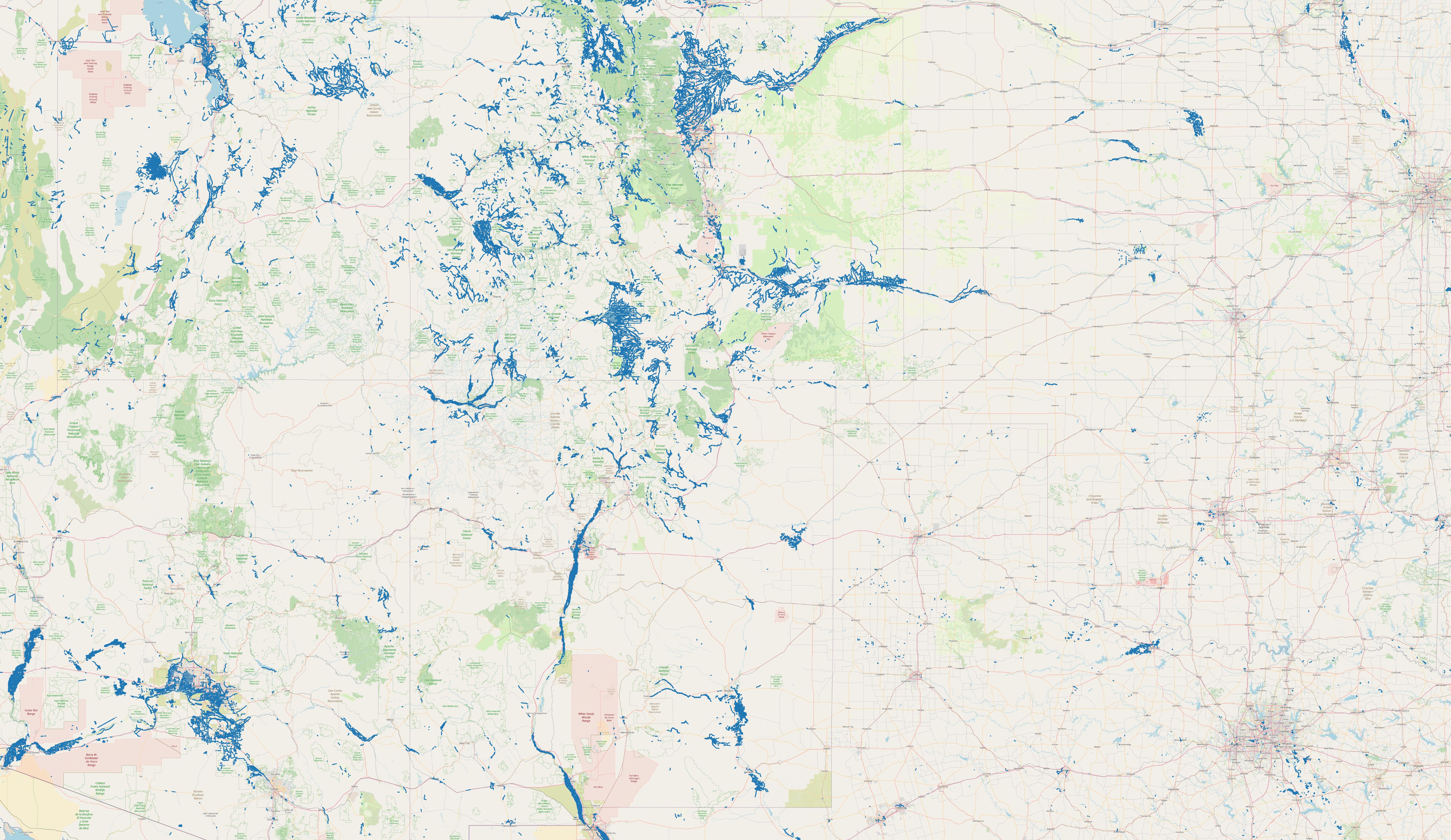
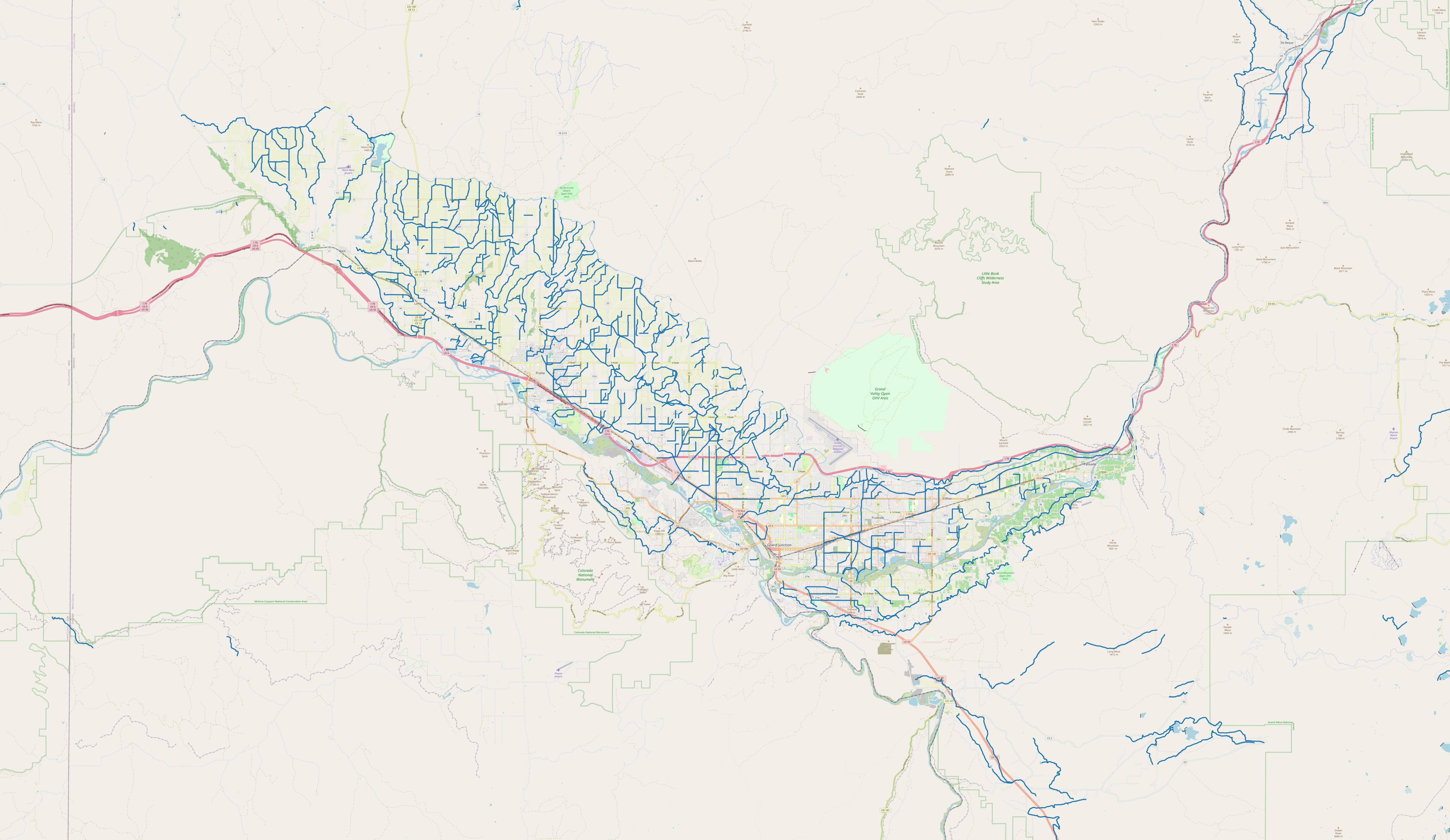
Here are some screen captures of the Southwest US and also the Grand Valley in Colorado. The patterns of irrigation development are correlated with the population density map (above).
Southwest US irrigation

Map data sourced from the National Hydrography Dataset (NHD), U.S. Geological Survey, ©OpenStreetMap contributors
Grand Valley, Colorado irrigation

Map data sourced from the National Hydrography Dataset (NHD), U.S. Geological Survey, ©OpenStreetMap contributors
Technical approach
-
Researched the NHD and found download options
-
Downloaded with
curland unzipped the national NHD file
curl -O https://prd-tnm.s3.amazonaws.com/StagedProducts/Hydrography/NHDPlusHR/National/GDB/NHDPlus_H_National_Release_1_GDB.zip
unzip NHDPlus_H_National_Release_1_GDB.zip
Contained in the zip archive is a 99GB geopackage file: NHD_H_National_GPKG.gpkg.
-
Explored the features and attributes in QGIS. The dataset has many layers and feature codes. For this quick exploration, I focused on the layer
NHDFlowLineand the feature code33600:"Canal/Ditch". -
Used GDAL/OGR to efficiently filter on the
fcodeattribute, producing a new geopackage file:canal-ditch.gpkg.
ogr2ogr canal-ditch.gpkg NHD_H_National_GPKG.gpkg \
    -sql "SELECT * FROM NHDFlowline WHERE fcode = 33600"
- In a new QGIS project, add an OpenStreetMap XYZ Tiles layer, and the
canal-ditch.gpkggeopackage.
I hope you enjoyed this ramble through a population map, precipitation map, and finally the NHD dataset.
🌎 Thanks for rambling! 👋🏼
- 2024-09-21 Fix attribution for population density map.
